


-
Mumbai recorded its highest rainfall in 107 years on the first day of the monsoon
-
Monsoon arrived earlier than usual, marking the earliest onset in 75 years, according to IMD
-
Heavy rains caused widespread waterlogging and disrupted train services on the Central Railway’s Harbour line
-
Services on Metro Line 3 (Aqua Line) were suspended due to flooding at an underground station
-
Nariman Point recorded the highest hourly rainfall at 104 mm, followed by A Ward, Colaba, and the Municipal Head Office
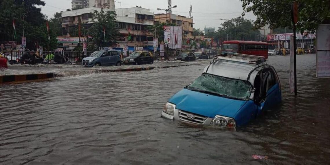
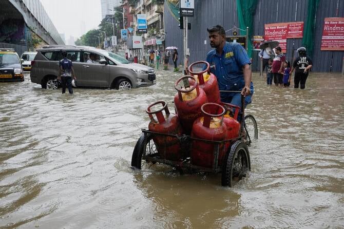
Mumbai woke up to a sodden Monday morning, May 26, as the southwest monsoon barreled into the city nearly 15 to 16 days ahead of its schedule. This is the earliest arrival ever recorded, since the India Meteorological Department (IMD) began collecting data in 1950. Breaking previous early onset records set on May 29 in 1971, 1962, and 1956, the 2025 monsoon has taken the city by storm, disrupting daily life.
According to the IMD, Colaba recorded 135 mm of rainfall by 8:30 AM, pushing the May total to a staggering 295 mm, the highest-ever recorded at the station in over a century. This surpasses the previous record of 279.4 mm set in 1918, ending a 107-year streak.
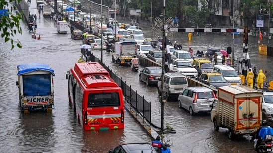
The downpour left arterial roads submerged, suburban train services crawling, and several neighbourhoods grappling with waist-deep waterlogging, bringing much of the city to a near standstill. Although the official monsoon onset date is June 11, authorities are bracing for a challenging and prolonged rainy season.
Monsoon 2025: Is India’s Financial Capital prepared?
Meteorologists and climate experts alike, point to this anomalous event as a stark indicator of shifting climatic patterns in the subcontinent. This raises urgent questions about infrastructure resilience and long-term preparedness in India’s Financial Capital, a city where monsoon is both a lifeline and a threat. So here are questions we often ask and the answers that might just surprise you!
Why is Mumbai’s monsoon early in 2025?
Mumbai usually waits until around June 11, to welcome the rains. But in 2025, monsoons arrived on May 26, two weeks early. Scientists and climate experts point to:
-
Warmer-than-average sea surface temperatures in both the Bay of Bengal and Arabian Sea added more moisture to the atmosphere.
-
Madden-Julian Oscillation (MJO): A slow-moving tropical disturbance, was in a phase that encouraged rainfall over the Indian subcontinent.
-
A robust Mascarene High in the southern Indian Ocean pushed moist winds more quickly toward India’s west coast.
-
The monsoon trough, a low-pressure corridor stretching from the Arabian Sea to the Bay of Bengal, opened early, allowing the monsoon winds to travel faster.
-
Reduced snow cover in the Himalayas led to faster heating of the northern plains, creating favourable pressure conditions.
-
Neutral El Niño conditions prevented any suppression of monsoon activity, allowing normal moisture buildup.
Why does Mumbai experience heavy monsoon rains & flooding?
Mumbai experiences heavy monsoon rainfall mainly due to its geographic location on the windward side of the Western Ghats. Moisture-laden winds from the Arabian Sea are forced to rise when they hit the Ghats, causing the air to cool and condense. This process is known as Orographic Lift, which results in intense downpours. The proximity to the Arabian Sea ensures a constant supply of moisture, fueling these heavy rains during the monsoon season.
However, the city’s dense urbanisation has compounded the problem. Much of Mumbai’s natural landscape has been replaced by concrete, limiting water absorption and increasing surface runoff. Additionally, traditional rainwater pathways such as nullahs, ponds, and mangrove belts have been encroached upon or blocked due to unchecked development. The destruction of natural drainage systems weakens the city’s ability to manage rainwater. As a result, flooding becomes a recurring challenge each monsoon, despite heavy rains being a natural consequence of its location.
How does IMD decide Red, Orange, and Yellow alerts?
The India Meteorological Department (IMD) assigns specific rainfall thresholds to its colour-coded weather alerts. These thresholds help determine the severity of the weather and guide public response. Here’s a breakdown of IMD rain alerts:
-
Yellow Alert (Be Aware): Issued when expected rainfall is between 64.5 mm and 115.5 mm within 24 hours. This indicates moderate rainfall that could cause localised disruptions.
-
Orange Alert (Be Prepared): Issued when expected rainfall ranges from 115.6 mm to 204.4 mm in 24 hours. This signifies heavy rainfall that may lead to significant disruptions in transportation, power supply, and could pose risks to life and property.
-
Red Alert (Take Action): Issued when expected rainfall exceeds 204.5 mm within a 24-hour period. This is the most severe alert, indicating extremely heavy rainfall with a high risk of widespread flooding and significant impact on daily life.
Why is rainfall measured in millimeters and not litres?
Rainfall is measured in millimetres to indicate how deep the rain would be, if it is collected on a flat surface. It’s standard, simple, and universal and applicable for all spaces, whether it’s a field, a terrace, or a park.
Example: If it rains 10 mm, that means 10 litres of water per square metre; like pouring 10 water bottles evenly across your balcony.
What does “XYZ % chances of rainfall” really mean?
When a forecast says there’s a “XYZ% chance of rain,” it doesn’t mean it will rain for XYZ% of the day or that per cent of the city will get wet. Instead, it means that there’s an XYZ% chance that any single point in the forecast area (like your neighbourhood) will receive measurable rain during the forecast period. Ultimately, the forecast reflects where it might rain and how likely that is; not how long it will rain or how heavy it will be.
Example: If the forecast says 50% chance of rain in Mumbai, it might pour in Andheri East while South Mumbai stays completely dry and the forecast would still be correct.
Monsoon 2025: Is India’s richest municipal corporation prepared?
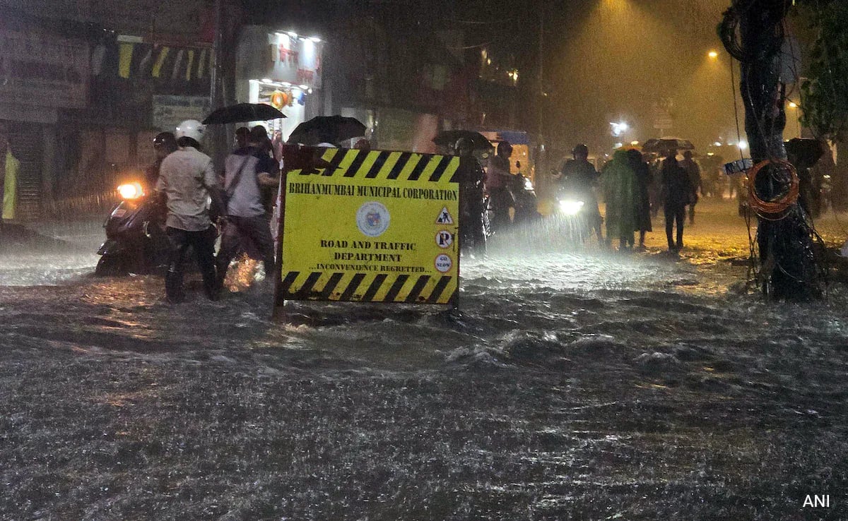
As the southwest monsoon arrived in Mumbai on May 26, it brought more than just torrential rain. It brought a hard question to the forefront: Is India’s richest municipal body, the Brihanmumbai Municipal Corporation (BMC), prepared for the scale and speed of today’s climate extremes? Despite disbursing crores annually on pre-monsoon preparedness, the early deluge turned vast sections of the city into waterlogged zones within hours.
BMC’s initiatives include the activation of 481 dewatering pumps, the installation of mobile pumps for rapid deployment, and the integration of Internet of Things (IoT) sensors for real-time monitoring of pump functionality. Additionally, the BMC has identified 453 flood-prone spots, with 369 addressed through drainage enhancements and the installation of high-capacity pumps. However, 55 spots remain, with mitigation efforts scheduled to continue through 2026.
Climate-driven rainfall outpaces existing infrastructure
Despite a raft of pre-monsoon measures, Mumbai’s early brush with the southwest monsoon has laid bare the city’s enduring vulnerability to extreme weather. Even as the BMC races to modernise its systems, the scale and intensity of climate-driven rainfall events are outpacing existing infrastructure.
Heavy rainfall led to significant waterlogging and disruptions in several areas on Monday, including the flooding of the new Worli underground metro station (Metro Line 3 – Aqua Line). The early onset has highlighted the need for continuous improvement in drainage capacity and the implementation of real-time flood forecasting systems to mitigate the impact of extreme weather events. These must become central to Mumbai’s future or the next downpour will once again leave the city drowning in its own unpreparedness.
Monsoon has come. Water has risen. And so must accountability!
Mumbai’s early monsoon arrival has tested the city’s infrastructure, and once again, the cracks are showing. Despite the BMC’s billion-rupee war chest and ambitious claims of preparedness, flooded roads, stranded commuters, and submerged infrastructure tell a different story.
The numbers look impressive on paper: hundreds of dewatering pumps, IoT-enabled monitoring, and drainage upgrades across key flood-prone spots. Yet, the reality on the ground suggests a civic system that remains reactive rather than adaptive! A city that runs on resilience, it’s time the system caught up with its people.